eLe{va}T[ioN] (J)oT.MaPs
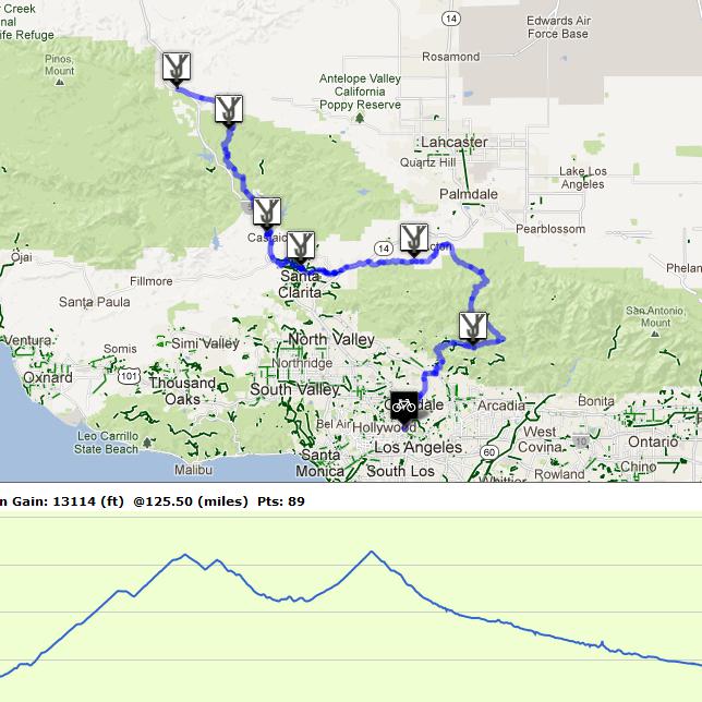
JoT [Journal of Training] maps now has elevation graphs.
Cool shit. I finally found the time to integrate Google’s new Visualization API and elevation data. The map below outlines YonderJournal’s Brovet from Los Angeles to Gorman starting at the GoldSaddleCyclery near Silverlake.
If you’d like to join me for the ride: Sunday May19 (send an email for information about departure time etc.)
To view the map: http://www.entryworks.com/JoTMaps
The markers on the map indicate the control points you must attend to get the prize patch {more cool shit}.
Posted: April 16th, 2013 under Features.
Write a comment
You need to login to post comments!


